G/Interaqua

We use cookies to ensure the best experience and improve the performance of our website.
For more information, see Terms & Conditions and Privacy Policy.

Click to accept

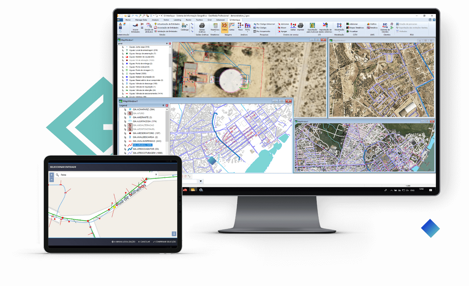
GIS solution focused at infrastructure management

8 countries
8
countries
60 companies
60
companies
60 000 km networks
60 000
km networks

How it works?

Data collection and integration

1

Registration data are collected, maintained and systematized in models specifically prepared for water and sanitation networks, waste, industry, telecommunications, energy, land use planning, territorial information and maintenance. Integration with CRM, ERP, Asset Management and Operation Management systems is carried out

Integrated analysis

2

Cross analyzes are carried out, based on data from the integration with other information systems of the Management Entity Results are available in G/Interaqua and in systems that are integrated

Efficient Network Management

3

Operational and maintenance data, as well as economic, financial and specialist data are collected and combined to produce context information for control and decision making.

G/Interaqua

Benefits of using G/InterAqua

Systematization and rationalization of information

Quality of information for planning, exploration and maintenance activities

Expand the spectrum of network management, historical, statistical and thematic analysis

Production and management of infrastructure registration information

Support for loss and leakage control programs

Management of Water Quality Control Plans (PCQA/PCO)

Production of performance indicators (KPI's)

Reporting and Mapping

Queries and statistical summaries

Systematization of information for the hydraulic modeling of water and sanitation networks

Distribution of consumption

Investment analysis based on infrastructure characteristics

Management of the service quality assessment process / reporting to the Regulator

Integration with information systems No duplication of data collection and updating

back to solutions